Soil Surveying and Land Management Planning
As part of our commitment to the development and management of quality vineyards, we offer a service for assessing the land capability of either potential viticultural sites or existing vineyards. Utilising the latest technologies available the service provides a detailed report on the soil types and other boundaries across the property and recommendations on vineyard design and management.
Assessment A soil survey is carried out to determine the soil types present, their boundaries and their physical and chemical properties. The survey is carried out in the following sequence:
- A reconnaissance survey is carried out using one or more of the soil sensing devices and GPS to determine preliminary soil boundaries and topography.
- Soil pits are excavated at representative locations for each soil type and the soil profiles described and analysed for key physical and chemical properties.
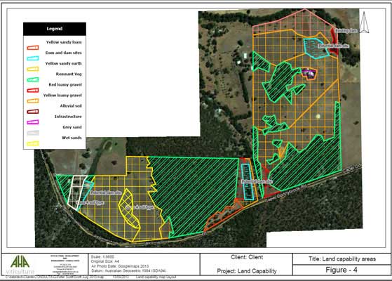
- Soil types are classified as to their suitability for viticulture and a range of soil type, topographical and vineyard design maps are generated.
Technology Soil sensing involves the 'on-the-go' collection of information related to soil properties, often employing one or more soil sensors. Accurate positional and elevational data can be collected at the same time. The most commonly used vineyard soil sensors at present include electromagnetic induction sensors, gamma-ray spectometers and ground penetrating radar. With the development of this equipment the collection of data can be performed at a greater spatial resolution than using manual methods. Experience has shown that by using this technology we are able to reduce the number of soil pits required to accurately map the soil type boundaries.
Reporting The report includes the following information:
- Areas will be classified as either being highly suitable, suitable, marginal, or unsuitable for wine grape production according to the WA Department of Agriculture's Land Capability class system
- Descriptions of soil pit profiles including: GPS location, potential capability class, rooting depth, depth to water table and horizon descriptions of colour, texture, % gravel and depth.
- Assessment of the site's climate, soil types, topography and regional pest and disease pressures.
- Recommendations on suitable varieties, block layout, row orientation, water resources, and management implications.
- A range of soil maps showing soil type boundaries.
- Topographical maps
- Proposed vineyard layout maps.
- Digital photos of soil profiles.
The digital format of this soil information is invaluable for the future management of the vineyard. All data is provided in digital format which can be viewed using software supplied with the report. Information using other precision viticultural technologies such as airborne remote sensing and yield monitors on harvesters can be added/superimposed for a greater understanding of the site and vine performance. If you would like more information on any of these services, please contact our office and we will direct you to the appropriate person:
Phone: (08) 9756 8011 Fax: (08) 9756 8033
For more information about Precision Viticulture technologies, please refer to the following website www.pvaustralia.com.au